Last summer was very wet. Very very very wet.
(photo by Larry Geiger, found online)
That, under the water, is Interstate 29. My parents had to drive quite a ways out of there way to get to work each day, on a highway that had flood waters lapping at the edges and was in danger of closing as well.
The state park near my home town, where I've countless weekends in my life, was completely under water. Up to 9+ feet in quite a few areas.
This weekend (July 14th), the
Friends of Wilson Island hosted tours of the park. Members of the public were able to see, first hand, the power of mother nature....and were also able to understand why the park is still closed.
Chris, the park ranger, narrated the tours and answered questions along the way.
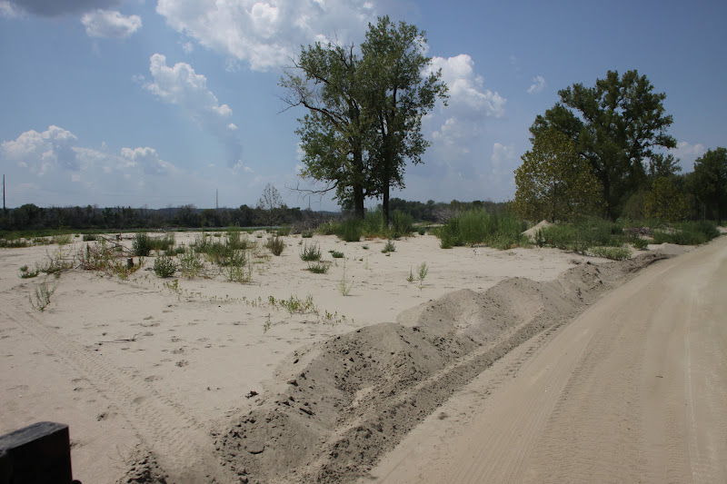
This was in the higher area of the park....flood waters were only around 3-4 foot deep here.
Trees are still falling daily. There was hope that more of them would live, after so many sprouted leaves this spring. But, as time goes on, the stress of last year's flood is proving to be too much for them to recover.
The park WILL be reopening. Sooner than I expected, actually. They estimate day use to be ready by this December, and it will possibly be open for camping next season.
The playground is half buried in silt and sand.
The sand dunes in the park are in a constant state of movement. At one time park staff dug a path to this restroom...and then scooped over 4 foot of silt and muck (by hand with shovels). As you can see, the sand is being blown back in.

Chris said he's measured up to 4 inches of sand shifting from one area to another within a weeks' time.
Portions of the park were completely buried under layer after layer of the stuff.
Heavy equipment was used to dig out the roads in certain sections of the campground. As we were driving along, every once and a while you could see the top of a fire grate or picnic table under all of the silt.
The main shower house didn't weather the storm nearly as well as the small "outhouse" latrines around the park.
Not only did the cabin get shifted around in the flood waters...but when the trees started falling, it was struck.
There are wooden markers on this power pole, showing previous year flood water levels. The bottom two markers are fairly recent (90's)....you can see the water line level from last year quite a ways above them.
Will the destruction was immense, I've seen this park recover from damage (both storm and flood water) with flying colors. I have no doubt it will do the same again. I can't wait to hike on the trails to see other changes we couldn't see from the roads.